|
Welcome to our mapshop!
On Atlasandmap.com you will find the original map, plan, view or print from the 16th to 20st century.
Read more about our firm
|
You can search our stock:
or browse our collection: |

|
Maps, Plans and Views
Worldmaps, continents, seas, the moon
countries, townplans and townviews |

| Prints
Prints on subjects as Animals, Medicine, Trains |

| Atlases and Books
Atlases, Reference books, Topographical books, Books with prints
|

|
Kuyper municipality maps
1200 very detailed maps of every spot in The Netherlands (dating 1865-1870)
|
Updated on 2024-04-29 with:
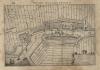
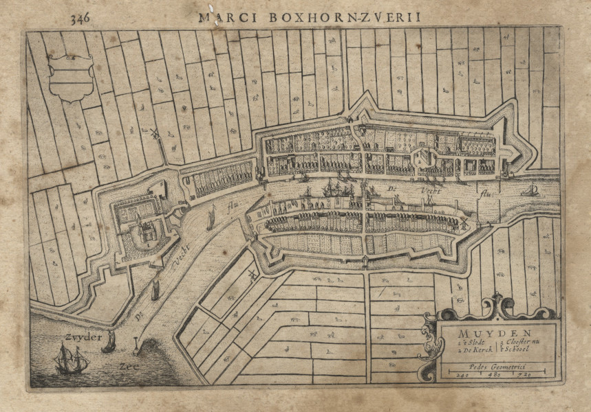 | Muyden
Made by M.Z. Boxhorn in: 1632
The size of the image is 23,5 X 16 cm
It is for sale for 68 euros |
most recently added maps and prints |
Link shortlist:
Worldmaps
Europe
Africa
Asia
North America
South America
Oceania
Northpole
Southpole
Hemispheres
Old World
The Netherlands
Drenthe
Friesland
Gelderland
Groningen
Limburg
Noord-Brabant
Noord-Holland
Overijssel
Utrecht
Zeeland
Zuid-Holland
|
Are you looking for information about a cartographer, engraver or publisher?
Then have a look at our cartographersdatabase which has more than thousand records.
 follow us on facebook follow us on facebook
You can read more about us.
www.atlasandmap.com
Gagal Galeries
Torenstraat 53
9648 JD Wildervank
The Netherlands
tel +31-6-44478398 / +31-6-44478398
www.gagal.nl
|
|
|
| |
| |